The China National Space Administration (CNSA) has shared the first high-resolution images of the surface of Mars taken by the orbiting probe of the Tianwen-1 mission. They show the polar ice caps and sand dunes with craters.
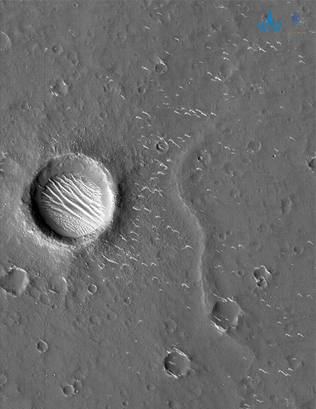
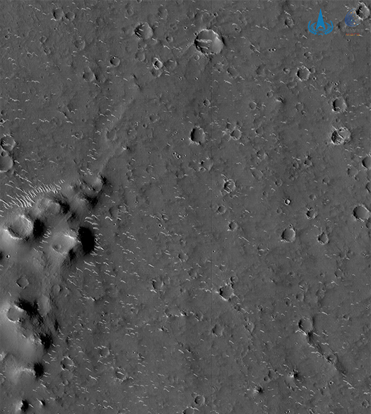
Two of the three published images were taken with a high-resolution panchromatic camera (70 centimeters per pixel) from a distance of 330-350 kilometers from the planet's surface.
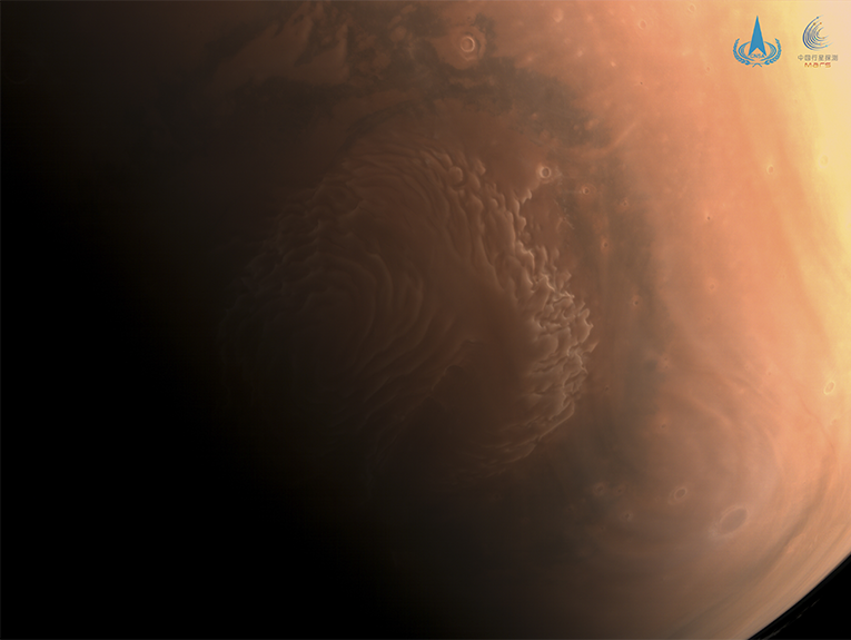
The third, color photo was taken with a medium-resolution camera, showing the north polar cap of Mars.
The probe explored the impact basin of the Utopia Planitia, where the rover of the Chinese mission should land in May-June. The diameter of the largest crater in the pictures is about 620 meters, and you can see sand dunes inside and nearby.
The Tianwen-1 mission is China's first to explore the Red Planet. Its launch took place on July 23, 2020, and the spacecraft entered the orbit around the Red Planet on February 10, 2021. From February 26, it began its scientific research, in particular, photographing the surface of Mars and studying its mineral composition.
The main objective of the Tianwen-1 project, which includes an orbiter, deployable camera, a lander, and a rover, is a global exploration of the Red Planet using remote sensing, as well as a detailed study of one of its areas by a rover.
The results of the work of all components of the mission will help obtain topographic maps of the Martian surface with an indication of the characteristics of soils, the ionosphere, areas of water ice, and other scientific data.
In February, a queue of terrestrial spacecraft formed on Mars. NASA's Perseverance rover has landed on the planet and will continue the geological exploration of its predecessors. Also, the United Arab Emirates' Al Amal (“Hope”) probe successfully entered the orbit of the Red Planet as part of Arab world's first interplanetary space mission to Mars. On February 14, the probe sent the first photo of Mars back to Earth.